Mountains and parks
Si Nan National Park and the Pha Chu cliff
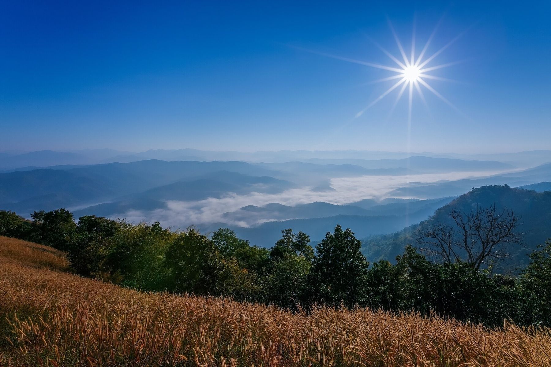
South of Nan town, forested ridges drop to the Nan River. Come in the cool season for mist at dawn, wide views from the cliffs and a quiet night under canvas.
- Getting there
- By road south from Nan town
- Bring
- Warm jacket, torch, water, sturdy shoes
- Dress and manners
- Cliff edges have few railings and loose rock. Wear shoes with grip, keep back from drops, and bring a warm layer for dawn.
- From the old town
- Around two hours south by road
Si Nan National Park stretches along the hills south of Nan town, on both sides of the Nan River as it winds towards the plains. It is smaller and quieter than the big parks of the north, and far less visited than the parks around Chiang Mai. What it offers is simple: forested ridges, grassy hilltops with long views, cliffs above the river and, in the cool season, valleys filled with mist at dawn.
The park reaches into several southern districts of the province, and the road there passes rice fields, small towns and temples. Most visitors come for one or two of its viewpoints and a night in the campground. This guide covers those viewpoints, the seasons and the practical side of a visit.
The Pha Chu cliff
Pha Chu is a cliff high above the Nan River, and it is the viewpoint most closely linked with the park. From the top the land falls away to the river, which bends through the valley below, and the ridges beyond fade into layers of blue on a clear day.
The walk to the cliff runs through forest and over rocky ground, with steep sections near the end. It is not long, but the final stretch asks for care. There are few railings, and the edge is a real drop. Keep children close and stay back from the rim, especially when the rock is damp.
The cliff faces the open valley, and the light is best early or late in the day. In the middle of the day the view flattens and the rock grows hot.
Doi Samer Dao and the sea of mist
The other famous spot in the park is Doi Samer Dao, a grassy hilltop that serves as the main campground and viewpoint. The open slope looks over a wide stretch of hills, and from about November to February the valleys below often fill with mist overnight. At sunrise the ridges stand out of it like islands.
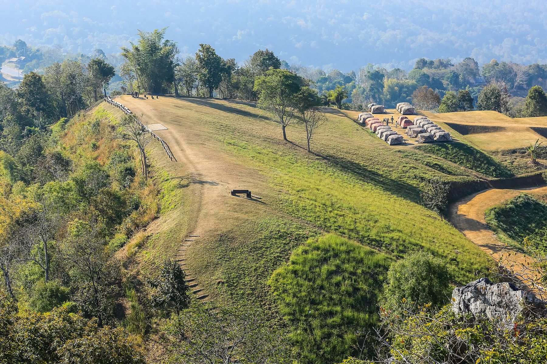
The hilltop is also a good place to watch the night sky, which is dark away from town. The name is often translated as a hill level with the stars, and on a clear, cold night it earns it.
Many people camp here to be on the slope at first light. Tents can be rented from the park at some times, and you can bring your own, though rules and arrangements change. Weekends and public holidays in the cool season are busy, and the slope can fill up. A weekday visit is calmer.
Also in Nan: Doi Phu Kha and the mountain road
The Lion Head Cliff and other viewpoints
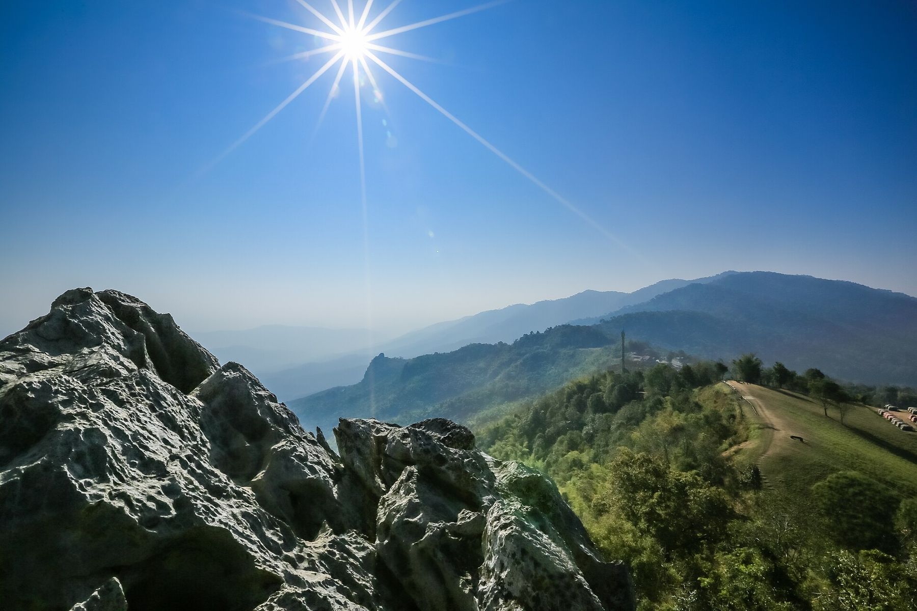
Close to the hilltop campground, a rough outcrop of grey rock known as Pha Hua Singh, the Lion Head Cliff, rises above the slope. Seen from the right angle the rock suggests a lion's head, and its top gives a view back over the campground and along the ridge. The rock is sharp and uneven, so climb with care and use your hands.
The park also looks after other sites in the south of the province. The best known are the eroded earth pillars at Sao Din Na Noi, tall columns of soil and sand that stand in a small valley. They are a short drive from the main road and pair well with a day in the park, though midday heat there can be fierce.
Forest and river
Most of the park is forest: mixed deciduous woods on the lower slopes, which turn dry and open in the hot season, and evergreen patches in the damper valleys. Short trails near the headquarters lead into it, and waterfalls run strongest after the rains. Birds are easiest to find in the early morning, when the forest edges are loud and active.
The Nan River runs through the park on its way south, wide and calm in the dry months and brown and fast in the rains. The river is the same one that flows past Nan town, where the long-boat races are held in the late rainy season. Seeing it here, far from town and deep between forested hills, gives a different sense of how much of the province it drains.
Seasons and the road
The cool season, roughly November to February, is the main season: clear skies, cold nights and the best chance of mist. Bring a proper jacket and a warm sleeping bag if you camp, as nights on the hilltop can be cold.
The hot season from March to May is often hazy, and smoke from fires across the region can hide the views for days. In the rainy season the forest turns deep green, but cloud can sit on the ridges and the roads become slippery. The roads to the viewpoints are steep and winding. Take them slowly, use a low gear on descents, and drive with great care in the rains or after dark.
Si Nan is a national park, and entry fees apply, with different rates for Thai nationals and foreigners. The visitor centre can tell you which trails and viewpoints are open.
- Arrive at the hilltop the evening before if you want sunrise.
- Carry water and a torch, and take your rubbish home.
- Keep back from cliff edges and loose rock.
A day in the park sits well before or after a slower day in town, among the temples and the old streets of Nan's old town.
Before: Nan old town · Next: Khun Nan National Park · Same topic: Doi Phu Kha National Park, Sao Din Na Noi, Khun Nan National Park
Images: Chalerm Achamana, CC BY-SA 4.0; piith.hant, CC BY-SA 4.0; piith.hant, CC BY-SA 4.0.


