Mountains and parks
Doi Phu Kha and the mountain road
High forest, cold mornings and a road that climbs in hairpins: the national park in Nan's northern mountains rewards an early start and a warm layer.
- Getting there
- By road north via Pua, then uphill
- Bring
- Warm layer, rain jacket, torch, grippy shoes
- Dress and manners
- Mornings near the summit can be cold in the cool season. Wear layers and shoes with grip; trails turn slippery and leech-prone after rain.
- From the old town
- About two hours north by mountain road
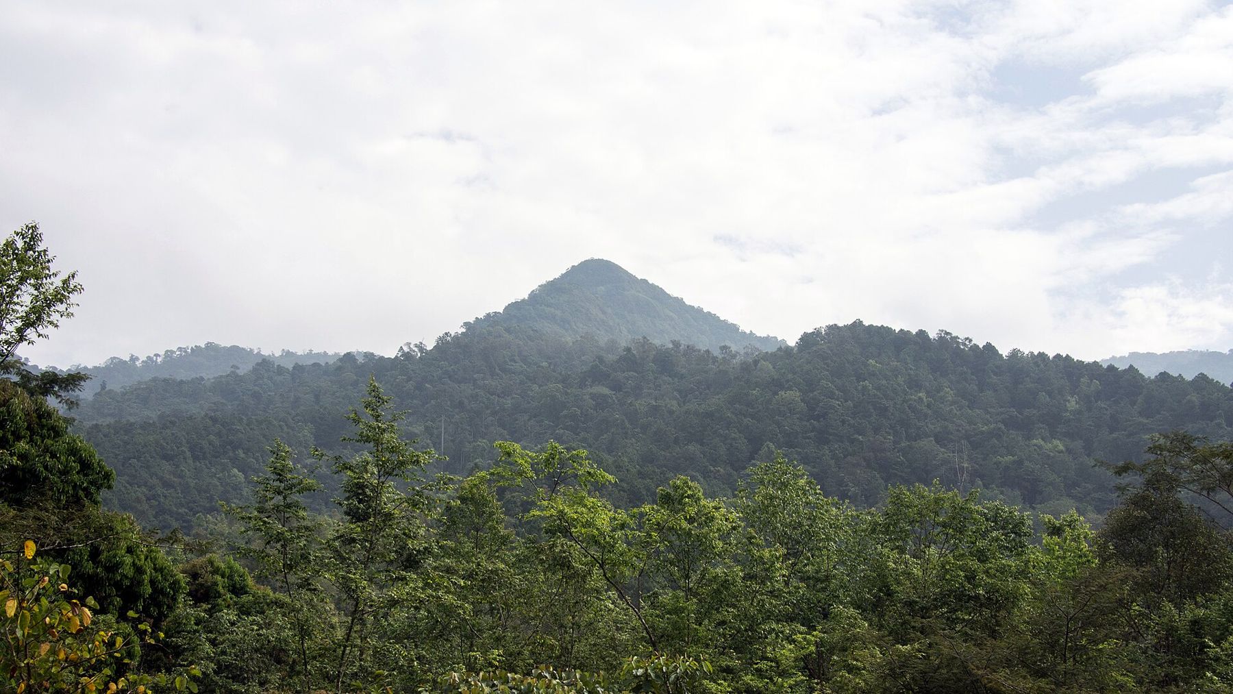
Doi Phu Kha National Park covers a long block of mountains in the north of Nan province, rising above the valley towns of Pua and running east towards Bo Kluea. It is one of the larger protected areas in northern Thailand, and its highest peaks stand close to 2,000 metres. From the valley floor the range looks like a dark green wall. Once you are on the road that crosses it, the park becomes a series of switchbacks, viewpoints, forest trails and cold, clear mornings.
The name comes from the mountain itself, Doi Phu Kha, whose summit lies in Pua district. Most visitors never climb it. They come for the drive, the views over folded ridges, the chance of a sea of mist at dawn and, in the right weeks, a rare tree in flower. This guide covers what the park offers, how the seasons change it, and how to treat the road with the respect it needs.
The mountain and the forest
The park protects a mix of forest types that change with height. Lower slopes carry mixed deciduous forest and bamboo, which thin out and turn brown in the dry months. Higher up, evergreen hill forest keeps its leaves all year, and the air under the canopy stays damp and cool. On the highest ridges you find montane forest with mosses, ferns and lichens on the branches, and the temperature can drop sharply after dark.
The summit of Doi Phu Kha rises above the headquarters area as a steep, forested cone. It is often wrapped in cloud by late morning, so if you want to see its outline clearly, look early.
The forest feeds several streams that run down into the Nan River system, and the park matters for the water supply of the valleys below. Villages of the Hmong, Mien and other upland peoples sit around and within the wider area, and parts of the land have long been farmed. Treat fields, paths and village edges as working places rather than scenery.
The Chomphu Phu Kha tree
The park is best known in Thailand for a single tree species. The Chomphu Phu Kha, a tall tree that carries clusters of pink flowers, grows wild in very few places in the country, and this park is the best known of them. It was recorded here only a few decades ago and has since become a symbol of the park and of Nan province.
The trees usually flower in the cool, dry weeks around January and February, though the timing and strength of the bloom change from year to year. When the flowers come, the area near the trees can be busy, especially on weekends and public holidays. These are wild trees on steep ground, and trampled roots do lasting harm.
Away from the flowering season the trees are simply part of the forest, and you would pass them without noticing. That is no loss. The park is worth the drive in any month, and the Chomphu Phu Kha is one reason among several.

Wildlife you may meet
The damp forests here are rich in small animals. Frogs, lizards and snakes are far easier to find than mammals, and night walks along streams are when most of them appear. Green odorous frogs sit on low branches near running water. Spiny frogs keep to leaf litter on the forest floor, and stream skinks bask on wet rocks by day. The park also has several snakes, including green pit vipers, which are venomous and well camouflaged against leaves.
Also in Nan: Si Nan National Park and the Pha Chu cliff
None of this should put you off walking. Snakes avoid people and most bites happen when someone reaches into foliage or tries to handle an animal. Watch where you put your hands, carry a torch after dark, and give any snake a wide berth. Leeches are common on trails after rain, and long socks tucked over trousers help.

Birds are another reason to come early. In the hour after sunrise, the forest edges around the headquarters and along the road are loud with calls, and mixed flocks move through the canopy. You need patience and binoculars rather than a long hike.

Cold mornings and the sea of mist
From roughly November to February the weather in Nan is dry and clear, and the mountains turn cold at night. At the higher viewpoints in the park, dawn temperatures can fall close to freezing in the coldest spells, while the afternoon is pleasant in sunshine. This is the season when cool air settles in the valleys overnight and leaves a sea of mist below the ridges at first light.
This is the season when cool air settles in the valleys overnight and leaves a sea of mist below the ridges at first light.
To see it, you need to be at a viewpoint before the sun climbs. The mist usually burns off within a couple of hours. Staying overnight inside or near the park makes this much easier than driving up in the dark. The park has a campground and some basic lodging run by the park service, and the rules for booking and for camping change. If you camp, bring a sleeping bag rated for real cold, not a light sheet.

The hot season, from about March to May, brings haze from fires across the region, and views can disappear for days. The rains then turn the forest a deep green and fill the waterfalls, but clouds sit low on the ridges and the trails become muddy.
The road over the mountains
The main road through the park climbs out of the Pua valley and crosses the range towards Bo Kluea. It is paved, but steep and winding, with tight bends, sharp drops and long stretches of first and second gear. Brakes heat quickly on the descent. Use a low gear rather than riding the brake, and stop at the viewpoints to let the car and your passengers rest.
In the rainy season, landslides and fallen trees sometimes close or narrow the road, and patches of mud and gravel appear on the bends. Drive with great care in the rains, avoid the road after dark if you can. Fuel up in the valley towns, as stations on the mountain are few.
Many travellers make a loop: north from Nan town to Pua, over Doi Phu Kha to the salt wells at Bo Kluea, and back to Nan by another road through the hills. The loop takes a long day at minimum and is far better over two. On the way north you can stop among the farms and rice terraces around Pua, and the Tai Lue villages of the valley are close to the route, with weaving on looms under the houses.
Doi Phu Kha is a national park, and entry fees apply for visitors, with different rates for Thai nationals and foreigners. The visitor centre near the headquarters has maps and can tell you which trails are open.
- Start early. Mornings are clearer, cooler and quieter than afternoons.
- Carry water, snacks and a warm layer, even on a sunny day.
- Keep to marked trails and take your rubbish back down.
- Leave plants, flowers and animals where you find them.
Back in town, the old temples make a gentle contrast to the mountain. An afternoon at Wat Phumin and its murals after a day in the hills shows two sides of the same province: the forest that feeds the valley, and the town that grew beside its river.
Before: Nan National Museum · Next: Sao Din Na Noi · Same topic: Sao Din Na Noi, Si Nan National Park, Khun Nan National Park · all notes
Images: Takeaway, CC BY-SA 3.0; Rushen, CC BY-SA 2.0; Rushen, CC BY-SA 2.0; Rushen, CC BY-SA 2.0; Rushenb, CC BY-SA 2.0.


